Subject: United States - Central
Period: 1843 (dated)
Publication:
Color: Black & White
Size:
30.2 x 36 inches
76.7 x 91.4 cm
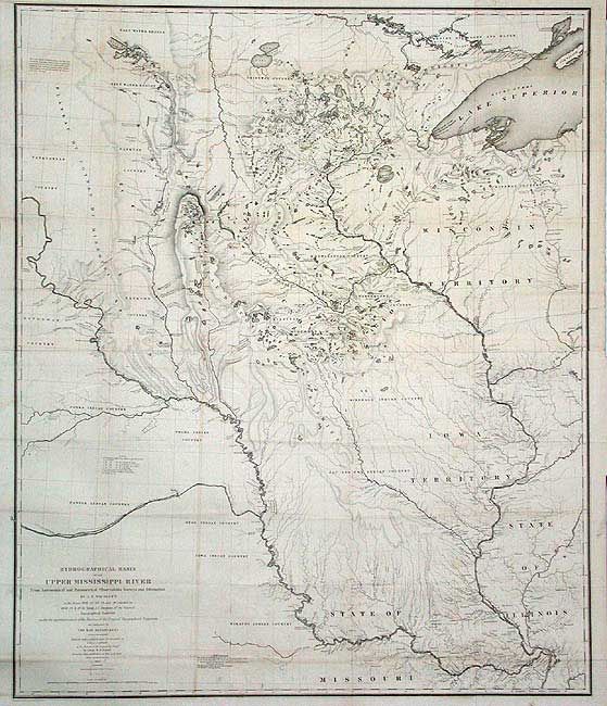
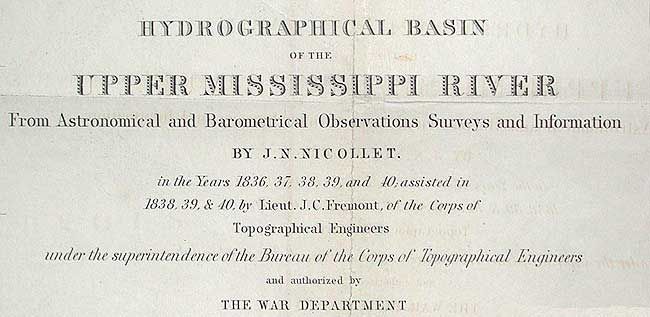
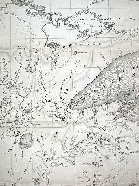
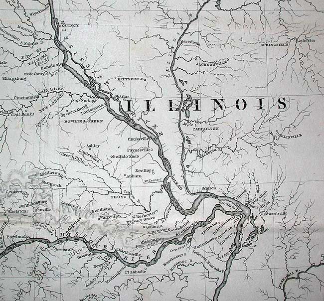
This extremely important map is the first accurate map of the interior, from St. Louis north to the international boundary. The map was compiled by Lt. W.H. Emory (under the direction of Col. J.J. Albert) from the surveys of J. N. Nicollet, who was assisted by Lt. J.C. Fremont. Thus, bringing together some of the most important names in the history of American mapping in the 19th Century. Nicollet was already a noted French scientist and topographer when he was chosen to lead the expedition during 1838 to 1840. It was the first truly scientific topographical survey of the interior of North America. The map reflects, for the first time, the use of the barometer to obtain elevations and the use of place names on maps based on a systematic analysis of Indian and French place names. Contempory cartographyer, Lt. G.K. Warren, called it, "one of the greatest contributions ever made to American Geography."
References: Claussen & Friis #390; Schwartz and Ehrenberg, p. 267-268, plt. 165.
Condition: A
Issued folding, now backed with archival tissue. A little toning along folds, still very good for a map of this size and age.