Subject: World
Period: 1681 (published)
Publication: Speculum Solis
Color: Black & White
Size:
13 x 10.7 inches
33 x 27.2 cm
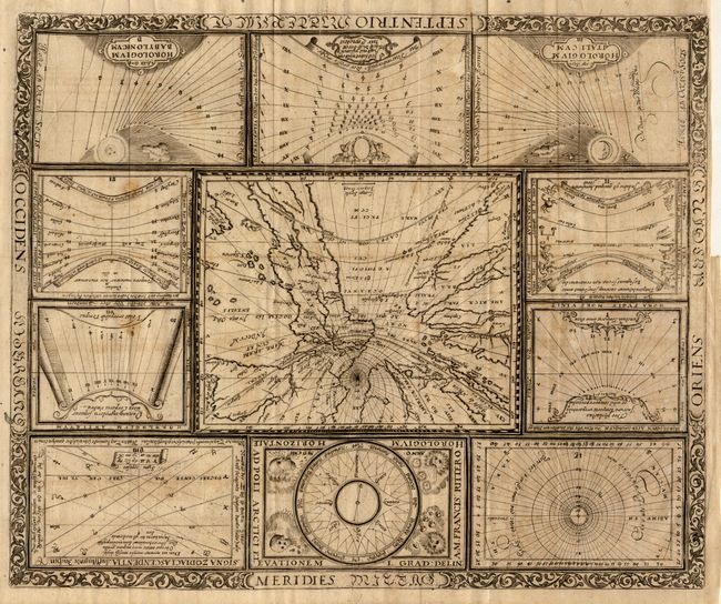
A rare and extremely unusual map projected from the North Pole as if it were the table of a sundial. The landmasses are drawn to scale in proportion to their distance from the pole. The result is a very distorted, though mathematically correct, projection. Ten horological diagrams surround the central map and all are enclosed in a decorative border. The plate was designed for Ritter's first edition of the Speculum Solis in 1607. It is a synopsis of all the plates that appear in his later editions.
References: cf Shirley #270.
Condition: A
Professional repair of a tiny binding tear into border at left. Minor printer's crease at bottom right.