Subject: United States - Eastern
Period: 1794 (dated)
Publication: An Historical Geographical, Commercial and Philosophical View of the American US
Color: Hand Color
Size:
18.4 x 14.4 inches
46.7 x 36.6 cm
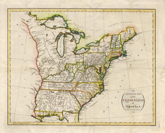
A very early map that details the fledgling states and the Indian lands east of the Mississippi River. Ohio is a small area divided into five regions labeled: Colonel Simmers, Seven Ranges, Army Land, Ohio Company, and Donation Lands from the Commonwealth of Virginia. Other interesting designations west of Ohio bear the labels Illinois Company, Wabash Company, and New Jersey Company. The area northeast of the Mississippi River is largely unorganized and denoted as "Divided into 10 States by a Resolve of Congress in 1784." A large section of Kentucky is Land Reserved for the Virginia Troops. The newly formed Tennessee Government is outlined with a large section Reserved for the N. Carolina Troops. Georgia extends to the Mississippi River. Various Indian tribes and forts are indicated throughout. The Twenty Leagues Line is drawn in the Atlantic.
References: McCorkle #794-14.
Condition: B
Fine impression and very nice color on clean paper. Some old repairs of fold splits, else fine.