Subject: Canada
Period: 1801 (dated)
Publication:
Color: Black & White
Size:
24 x 22 inches
61 x 55.9 cm
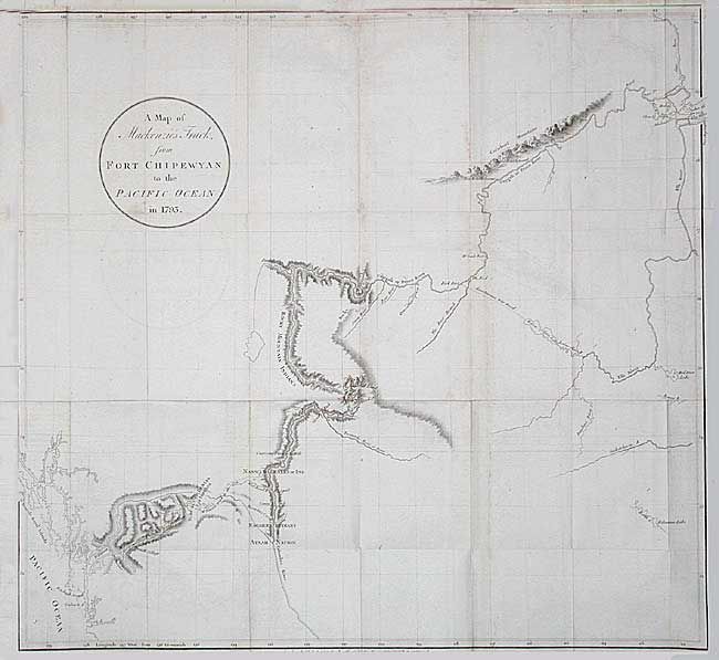
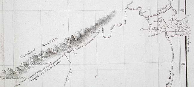
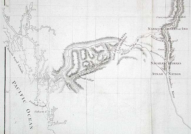
Alexander Mackenzie was the first white man to cross the North American continent north of Mexico and thus dispel the belief in a Northwest Passage to Hudson Bay. His epic journey was one of incredible hardship and marks an important page in the cartographic history of North America. This map is sparsely engraved with only the regions adjacent to his trek from Fort Chipewyan to Finlay Forks, south along the Parsnip River (headwater of the Peace River), then down the Herrick and McGregor Rivers to the Great Fork with the Fraser River (which he mistook for the upper Columbia). He followed the river until the rapids just above Williams Lake and then made his way on foot along established native trails to the Pacific at the mouth of the Bella Coola River. A scarce map rarely seen on the market.
References: Wagner/Camp #2; Wheat (TMW) #251; Hayes p. 95.
Condition: A
Folding as issued with a bit of light surface soil along folds and light offsetting that erases easily.