Catalog Archive
Auction 104, Lot 142

"A Map of Hudsons Bay and Straits", Jefferys & Faden
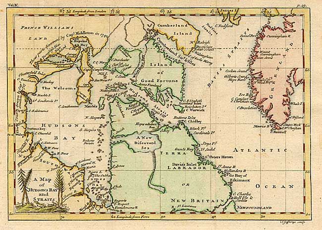
Subject: Canada

Period: 1756 (published)

Publication: A Compendium of Authentic and Entertaining Voyages

Color: Hand Color

Size:
8.4 x 5.9 inches
21.3 x 15 cm
Download High Resolution Image
(or just click on image to launch the Zoom viewer)

An uncommon little map including most of Greenland through Hudson Bay. It emphasizes the English expeditions in search of the fabled Northwest Passage. Notes the discoveries in the vicinity of Repulse Bay and Wager River by Capt. Middleton in 1742 and those of Capt. Smith along the coast from Buttons Bay to Chesterfield Inlet in 1747. It also locates a spurious New Discovered Sea in Labrador. Title in a small forested cartouche.

References: Kershaw #452.

Condition: A

Issued folding. Minor stains in blank margins, not affecting map.

Estimate: $80 - $100

Sold for: $110

Closed on 9/10/2003

Archived