Subject: Colonial Southeast
Period: 1765 (circa)
Publication:
Color: Hand Color
Size:
22.5 x 19 inches
57.2 x 48.3 cm
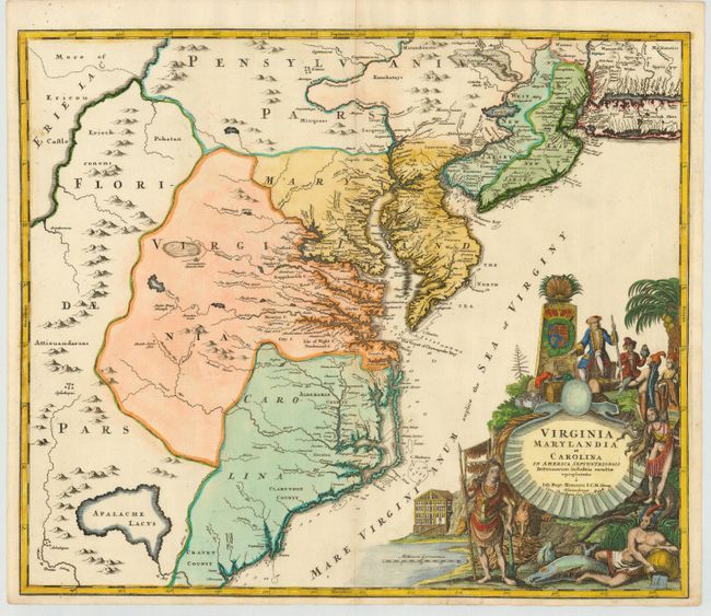
Handsome map of the mid-Atlantic colonies with a large, striking cartouche. There is a large hypothetical lake (Apalache Lacus) west of Craven County, Carolina and interesting notations in the Outer Banks. Some counties and many rivers of eastern Virginia are shown, but western Virginia is vague with only Germantown, Mister Krug's Plantation and Fort Christ Anna located. Florida is shown extending west of Virginia, all the way north to Lake Erie. Maryland along Cheseapeake Bay [sic] shows many rivers and towns with soundings in most bays. Philadelphia is clearly shown although Pennsylvania is divided by a rambling Susquehana River and is only vaguely depicted. New Jersey is divided vertically into west and east sections with a large Sandy Hook, a minuscule Manhattan, and a thin Long Island Sound. The bold, huge cartouche depicts European merchants, Indians, trade goods, and the fruits of land and sea.
References: Cumming (SE) #156.
Condition: B
Clean crisp impression with attractive later full color. Couple of small repaired holes and a repaired short tear into cartouche, now nearly invisible.