Subject: Colonial Southeast
Period: 1630-33 (circa)
Publication: Nieuwen Atlas ofte Werelt
Color: Hand Color
Size:
19.4 x 15 inches
49.3 x 38.1 cm
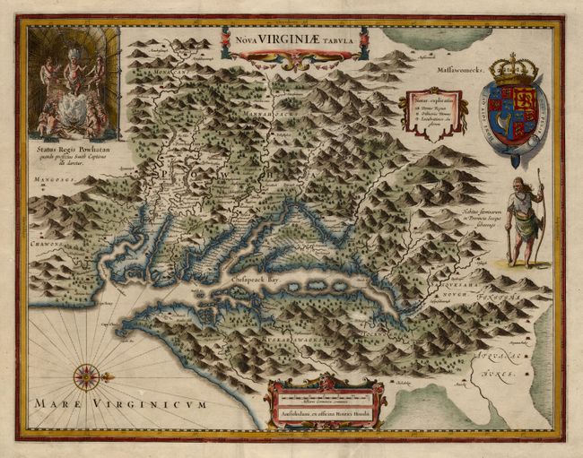
One of the most important maps of the Chesapeake Bay region, credited with disseminating knowledge of the English settlement in Virginia throughout Europe in the 17th century. The map is a derivative of Capt. John Smith's map of 1612, which was the first to depict the bay and its tributaries with any accuracy. In the upper left corner is an engraving of the great Indian chief Powhatan seated on his throne and surrounded by his subjects. A Susquehanna chief is depicted on the right under a coat of arms and cartouche. This is Henricus' version based on the map drawn by Jodocus Hondius Jr. This is the first state of the Latin edition with no text on verso and no page number.
References: Burden #228; Tooley (Amer) pp. 165-66.
Condition: A
Very sharp impression on thick paper. Soft fold and an old paper repair on verso.