Catalog Archive
Auction 104, Lot 136

"Mappa Geographica Provinciae Novae Eboraci ab Anglis New-York…Nova Jersey ex topographicis observationibus", Sauthier, Claude Joseph

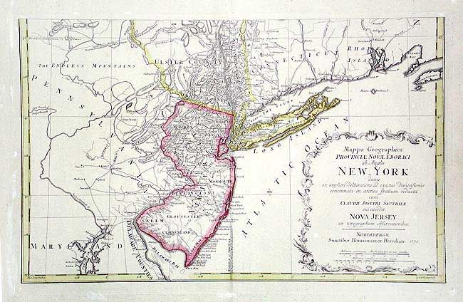
Subject: Colonial Mid Atlantic

Period: 1778 (dated)

Publication: Atlas Geographicus Maior Exhibens…

Color: Hand Color

Size:
22.5 x 14.4 inches
57.2 x 36.6 cm
Download High Resolution Image
(or just click on image to launch the Zoom viewer)

Lower sheet of a two-part map after Sauthier's 1776 map based on the surveys ordered by Governor William Tryon. Shows all New Jersey, Long Island, part of New York, part of Pennsylvania, Delaware Bay & Connecticut. It features the disputed line of partition between New York and New Jersey and county boundaries in New York. Good detail of towns and villages, roads, and coastal detail. Extends to include Annapolis and northward to shows all of Martha's Vineyard. This sheet has the title cartouche, uncolored as issued, published by Homann Heirs.

References: McCorkle #778.19; Sellers & Van Ee #1049.

Condition: A

On thick, course paper. Two small foxing spots, still very good.

Estimate: $500 - $600

Sold for: $375

Closed on 9/10/2003

Archived