Subject: Colonial New England
Period: 1740 (circa)
Publication:
Color: Hand Color
Size:
10.7 x 8 inches
27.2 x 20.3 cm
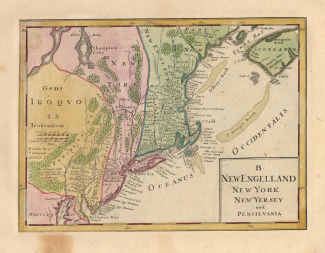
This interesting map was issued as the upper right quadrant of a map titled "Dominia Anglorum in America Septentrionale". It has been trimmed from the folio map and mounted on a large sheet of comparable 18th century paper, probably for inclusion in a composite atlas. The map is based on Herman Moll's postal map of New England. The post road is shown from Philadelphia to Piscataway. In New England the colonies of Plimouth, Connecticot and Massachusetts are located. Piscataway labels the region of present-day Maine.
References: McCorkle #740.1; Sellers and Van Ee #83.
Condition: B
Some staining in blank margins and a couple of unobtrusive tiny spots in map.