Subject: Colonial New England
Period: 1647 (circa)
Publication: Nouvel Atlas
Color: Hand Color
Size:
19.7 x 15.2 inches
50 x 38.6 cm
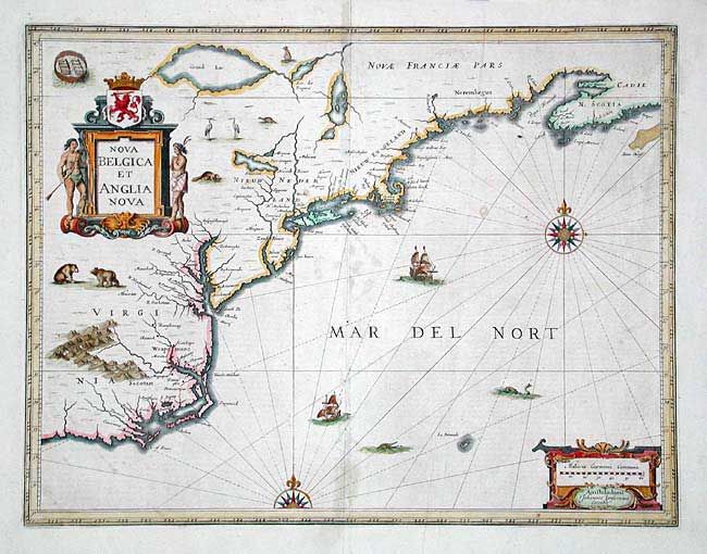
Jansson's influential map of the eastern coast of North America was first issued in 1636. It is derived from the less well know map of Johannes de Laet of 1630. The map includes part of the Great Lakes labeled Grand Lac and Lac des Yroquois, an unnamed Lake Champlain, and a fictitious lake at the headwaters of the Delaware River. This is the second state with the alternate title, giving greater prominence to the Dutch colonies, and with the addition of wildlife throughout the interior. French text on verso. Beautifully adorned with cartouches, ships, sea monsters and compass roses.
References: Burden #247; McCorkle #636.2.
Condition: B
A few insignificant light spots of foxing. Professionally reinforced centerfold. A few short tears in blank margins, closed with archival tape.