Catalog Archive
Auction 104, Lot 127

"Karte von den Seen in Canada Zur allgemeinen Historie der Reisen", Bellin, Jacques Nicolas

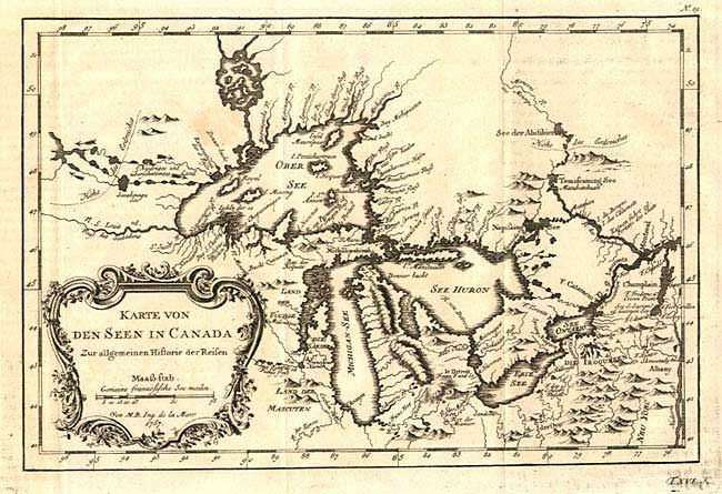
Subject: Colonial Great Lakes

Period: 1757 (dated)

Publication: Allgemeine Historie des Reisen zu Wasser unde Lande

Color: Black & White

Size:
11.2 x 7.5 inches
28.4 x 19.1 cm
Download High Resolution Image
(or just click on image to launch the Zoom viewer)

An excellent little map depicting the five Great Lakes based on Bellin's second important map of the Great Lakes (1755). Lakes Erie and Ontario are more accurately defined and the spurious islands in Lake Huron have been deleted. Several large islands still remain in Lake Superior, including the entirely incorrect I. Minong. The Michigan peninsula is still misshapen with the large mountain range down its middle. Chicagou appears at the southwestern end of Lake Michigan and many early forts are located throughout. Ornate rococo title cartouche draped with ivy.

References: Kershaw #954.

Condition: B

One light spot, else very good with a crisp impression.

Estimate: $350 - $400

Sold for: $325

Closed on 9/10/2003

Archived