Subject: North America
Period: 1829 (dated)
Publication:
Color: Hand Color
Size:
9.7 x 8 inches
24.6 x 20.3 cm
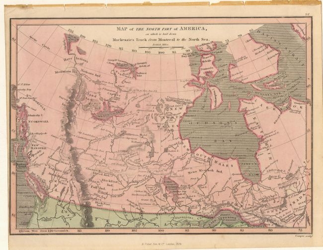
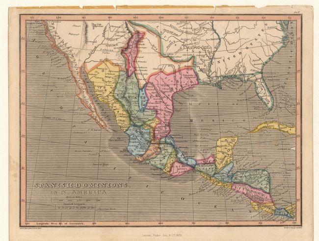
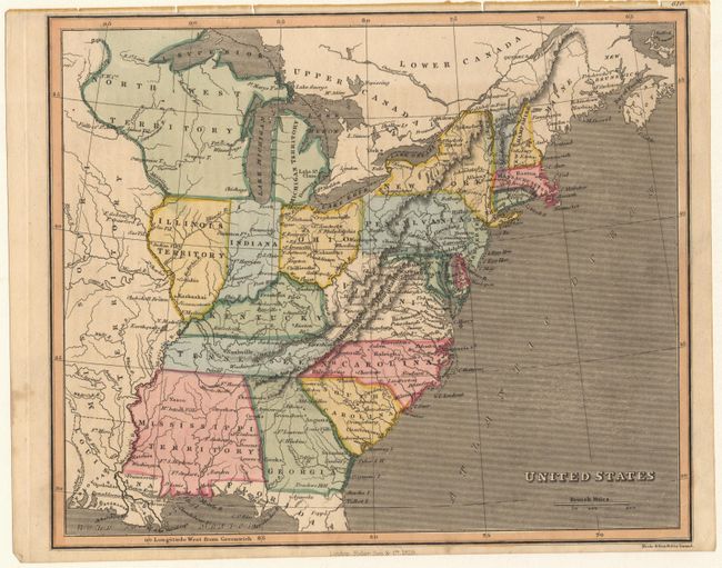
A matched set of maps covering most of North America. 1) Map of the North Part of America, on which is laid down Mackenzies Track from Montreal to the North Sea was engraved by Cooper and covers all of Canada except the eastern seaboard. 2) United States was engraved by Neele & Son and shows the states and territories east of the Mississippi River. The large Mississippi Territory encompasses both present-day Mississippi and Alabama, and North West Territory includes what is now Michigan, Wisconsin and part of the Dakotas. Numerous frontier settlements and forts are located. 3) Spanish Dominions, also engraved by Neele & Son, extends into the present-day Texas and the Southwest much of which is labeled Unknown Parts. Sizes vary slightly.
References:
Condition: A
First is closed trimmed at left neatline, as issued. All maps have minor stains in blank margins.