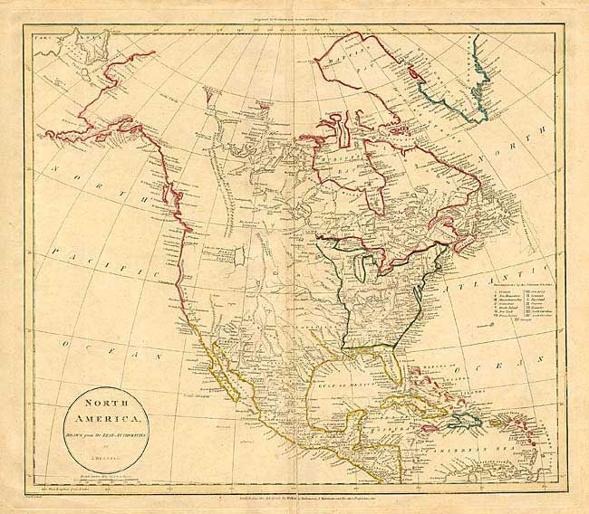
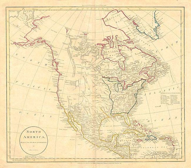
Subject: North America
Period: 1811 (dated)
Publication:
Color: Hand Color
Size:
17.7 x 15.5 inches
45 x 39.4 cm
Uncommon early 19th century map of the continent with several interesting notations, such as the one labeling a large lake in the approximate location of the Great Salt Lake, "Lake &c. laid down according to Mr. Lawrence, who is said to have travell'd through this Country to California in 1790 and 1791." Fifteen states are shown in the United States. The region west of the Mississippi is largely blank except for Indian names. Alaska is roughly formed. The map was originally engraved for Guthrie's New System of Geography.
References:
Condition: B
Centerfold toning. Separation on bottom centerfold extending 4" into map, with old paper repair on verso.