Subject: Russia
Period: 1626 (dated)
Publication: A Prospect of the Most Famous Parts of the World
Color: Hand Color
Size:
20 x 15.4 inches
50.8 x 39.1 cm
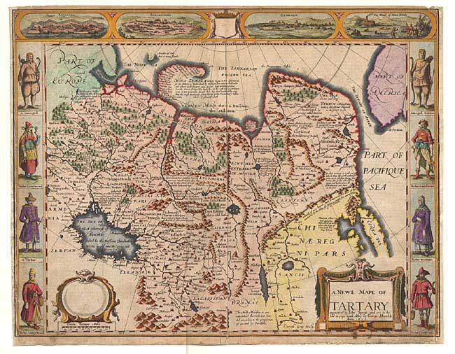
Carte-de-figures map covering the region from Lake Baikal through to the regions of present-day Manchuria and Siberia to the north of the Great Wall of China. Korea is shown as an island on the extreme right with parts of North America across the fabled Strait of Anian. The map is fully engraved with mountains and forests, the Great Wall, numerous towns and fascinating notations. Included in the four views at top is a view of Nova Zembla, the winter quarters of Barents, the Dutch explorer who searched for a northern passage between Russia and America. The other views depict important cities of the Silk Route - Astrakan, Samarkand and Cambalu. In the side panels are figures of the people Tartary in their native costume. The English text on verso provides a fascinating and amusing description of the region. First state with the imprint of George Humble in pops head Alley.
References:
Condition: C
Crisp impression and pleasant later color. Side margins replaced with neatlines in facsimile. Old repair at lower centerfold infilling a small hole. A presentable example that would benefit from professional conservation.