Subject: Persia
Period: 1698 (published)
Publication: Claudii Ptolemaei's Atlas Tabulae geographicae Orbis Terrarum
Color: Black & White
Size:
18 x 13.5 inches
45.7 x 34.3 cm
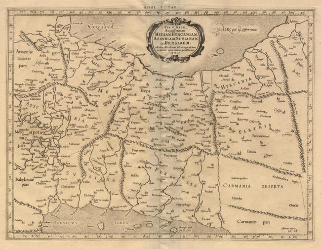
Fine Ptolemaic map depicting much of Persia (Iran), Mesopotamia (Iraq) and part of Armenia. The map stretches from the Persian Gulf to the Caspian Sea and features Babylon (Baghdad), the Tigris and Euphrates Rivers. Mercator originally published this map in his 1578 edition of Ptolemy's great Geography. Although he is most renowned today for the projection he popularized and for first using the term Atlas for a collection of maps, he devoted much of his life to his Ptolemaic maps. The maps were beautifully engraved as nearly as possible to their original form and embellished with fine cartouches and cultural scenes. This map is from an 1698 edition. The ornamental border of the map first appeared in this edition.
References:
Condition: A
Couple of small tears in blank margins. Soft crease on right side of map.