Catalog Archive
Auction 103, Lot 455
"[Lot of 2] Carte du Royaume de Juda, et d'Israel, suivant cette Historie [together with] Carte representant la situation des Etats des Cananeens, Moabites, Ammonites, Madianites, Idumeens Amalecites, &c…", Brion de la Tour, Louis
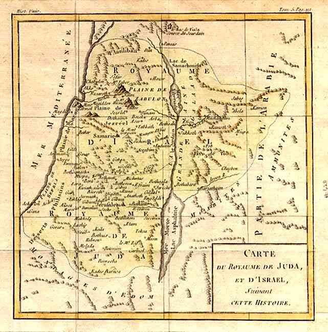
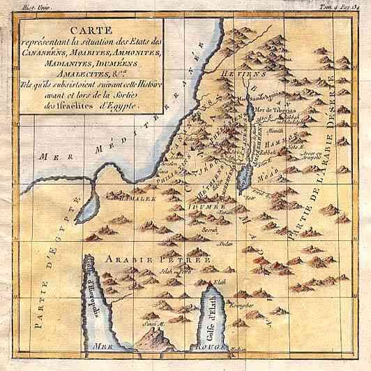
Subject: Holy Land
Period: 1766 (circa)
Publication:
Color: Hand Color
Size:
7.4 x 7.5 inches
18.8 x 19.1 cm
Download High Resolution Image
(or just click on image to launch the Zoom viewer)
(or just click on image to launch the Zoom viewer)