Catalog Archive
Auction 103, Lot 368

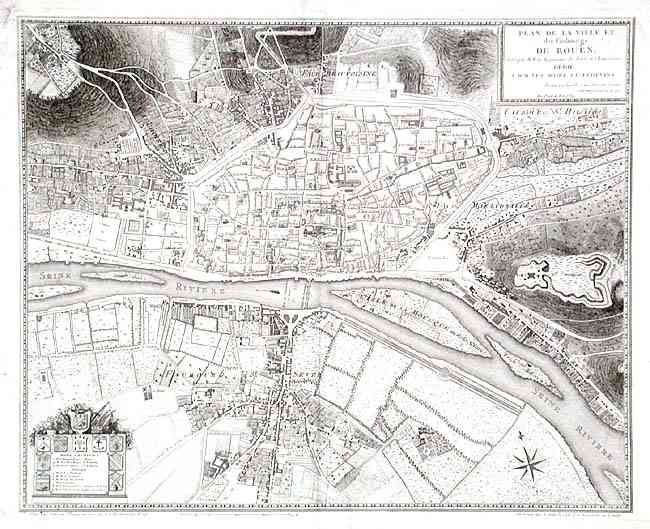
"Plan de la Ville et des Faubourgs de Rouen, leve par M. M. les Ingenieurs des Ponts et Chausees…", Lattre, Jean

Subject: France

Period: 1784 (dated)

Publication:

Color: Black & White

Size:
21.4 x 17.1 inches
54.4 x 43.4 cm
Download High Resolution Image
(or just click on image to launch the Zoom viewer)

Handsomely engraved map of Rouen (Haute-Normandie) centered around the Seine. Excellent detail of streets, buildings and the surrounding countryside. Names and locates important buildings from keyed list surrounded by ten coats of arms. Includes the Notre Dame Cathedral and shows Fort Ste. Catherine outside of town. Decorative cartouche and compass rose.

References:

Condition: B

Lightly misfolded-folded along center. Marginal flaws: tidemarks and a couple of stains, short tear next to centerfold. Map very good except for a few spots.

Estimate: $300 - $400

Sold for: $350

Closed on 6/11/2003

Archived