Subject: England & Wales
Period: 1675 (circa)
Publication: Britannia
Color: Hand Color
Size:
18.2 x 12.5 inches
46.2 x 31.8 cm
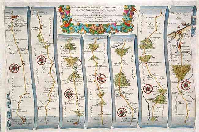
John Ogilby's 'Britannia' was published between 1675 and 1698. It is a landmark in the mapping of England and Wales. Its unique format constituted the first national road-atlas of any country in Western Europe. It was composed of maps of seventy-three major roads and cross-roads, presented in a continuous strip-form, on a uniform scale of one inch to a mile. Each beautiful map includes wonderful detail of the countryside with each strip containing a large compass rose to indicate changes in direction.
Handsome road map in the pictorial style pioneered by Ogilby. The map begins in Bramyard and proceeds in a easterly direction to the Welch port of Aberystwyth. A strapwork and garland cartouche completes the composition.
References:
Condition: B
Margins extended to accommodate framing.