Subject: England
Period: 1675 (circa)
Publication: Brittania
Color: Hand Color
Size:
18 x 12.8 inches
45.7 x 32.5 cm
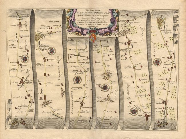
John Ogilby's 'Britannia' was published between 1675 and 1698. It is a landmark in the mapping of England and Wales. Its unique format constituted the first national road-atlas of any country in Western Europe. It was composed of maps of seventy-three major roads and cross-roads, presented in a continuous strip-form, on a uniform scale of one inch to a mile. Each beautiful map includes wonderful detail of the countryside with each strip containing a large compass rose to indicate changes in direction.
A graphic map of the road from Huntington to Ipswich, through the towns of St. Ives, Erith, Sutton, Ely, Soham, Bury and Wulpit. Decorative cartouche, coat of arms and compass roses. Accompanied by the English text leaf describing this route.
References:
Condition: A+
Finely colored, crisp impression with generous margins.