Catalog Archive
Auction 103, Lot 289

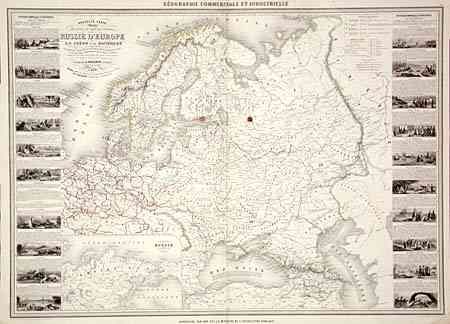
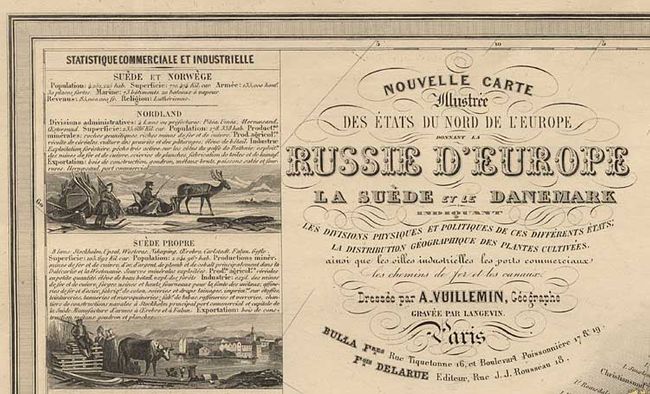
"[Lot of 2] Nouvelle Carte Illustree des Etats du Nord de l'Europe… [and] Nouvelle Carte Illustree Turquie d'Europe et de la Grece", Vuillemin, Alexander A.

Subject: Europe

Period: 1860 (circa)

Publication: Geographie Commerciale et Industrielle

Color: Hand Color

Size:
33 x 23.2 inches
83.8 x 58.9 cm
Download High Resolution Image
(or just click on image to launch the Zoom viewer)

Two scarce maps with elegantly engraved vignettes of the products and people of the region surrounding the maps. First covers northern Europe, focusing on Russia in Europe, but including the Netherlands and Scandinavia. Includes an inset map of the Empire of Russe. Second covers the Balkans and the Turkish Empire in Europe. Both with great detail throughout including railways, roads and canals.

References:

Condition: C

Original outline color. Couple of tears into map repaired with archival tape. Twin stains on either side of centerfold.

Estimate: $150 - $200

Unsold

Closed on 6/11/2003

Archived