Catalog Archive
Auction 103, Lot 222
"De Voor Eylanden van America Tegens de Vaste Kusten van Florida, Mexico, Nieuw Spanje, Cartagena Iucatan, en Darien", Aa, Pieter van der
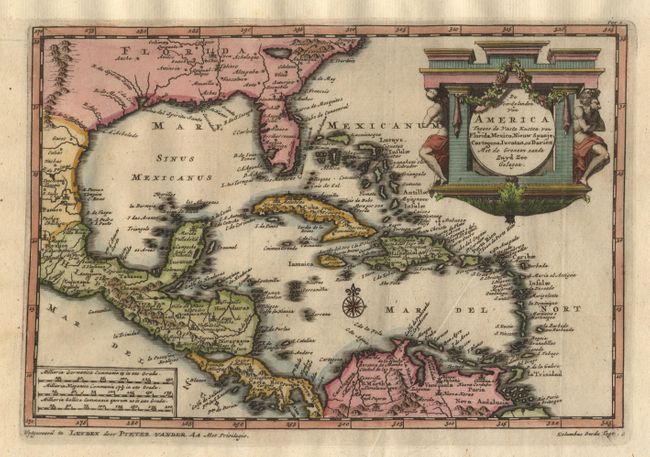
Subject: Gulf of Mexico and Caribbean
Period: 1710 (circa)
Publication:
Color: Hand Color
Size:
8.7 x 6 inches
22.1 x 15.2 cm
Download High Resolution Image
(or just click on image to launch the Zoom viewer)
(or just click on image to launch the Zoom viewer)