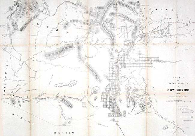
Subject: New Mexico and Arizona
Period: 1860 (dated)
Publication: Sen Ex. Doc. No. 1, 2nd Sess. 30th Congress
Color: Black & White
Size:
32.5 x 23 inches
82.6 x 58.4 cm
Early, large-scale, territorial map by the Surveyor Generals Office, Santa Fe New Mexico. Shows the territory prior to Colorado annexing San Luis Valley. Extends to the Colorado River and north to just show Salt Lake City. Locates numerous Indian villages and reservations, extent of surveys completed including Pueblo claims and subdivided townships. Limited detail in present day Arizona. Shows the Santa Fe Trail (wagon road to Ft. Leavenworth), and the wagon road to San Antonio. Good detail of mountains in hachure, springs, watershed and mineral locations.
References:
Condition: B
Tissue backed, toned along folds, else very good with crisp, dark impression on sound paper.