Subject: South Pacific - Solomon Islands
Period: 1788 (circa)
Publication: Atlas Encyclopedique
Color: Hand Color
Size:
13.5 x 9.2 inches
34.3 x 23.4 cm
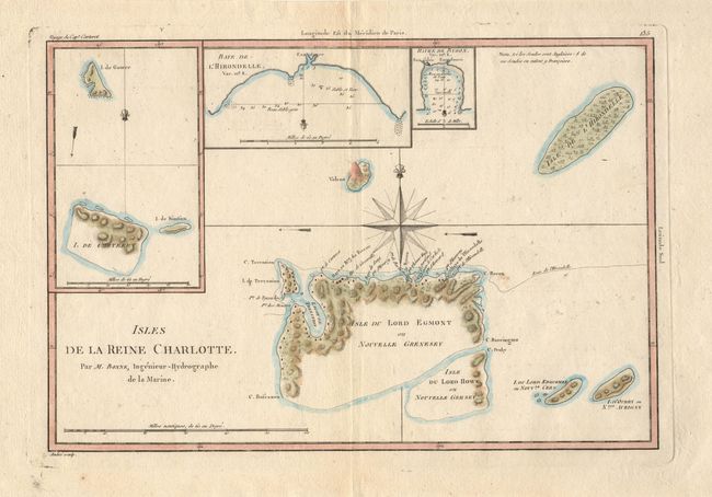
Lovely chart, based on Cook's voyages, showing a small part of the extensive Solomon Islands located east of Papua New Guinea. The Isle du Lord Edgemont, and Isle du Lord Howe islands have been only partially engraved to show the explored portions. At that time the group shown on the map was named for Queen Charlotte, wife of King George III. Insets of Carteret Island, Baye de l'Hirondelle and Havre de Byron. Main chart centered on a decorative compass rose, with a small volcano just west of it. Engraved by Andre.
References:
Condition: A
Excellent plate impression on fine, sturdy paper. Couple of small spots of foxing and light damp stain in blank margins.