Catalog Archive
Auction 102, Lot 498

"The New Correct Mapp of Calbar River vulgarly call'd Calabar… [together with] [Four sheets with Prospect Views]", Churchill, John

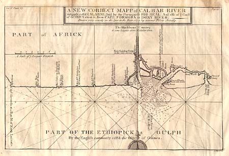
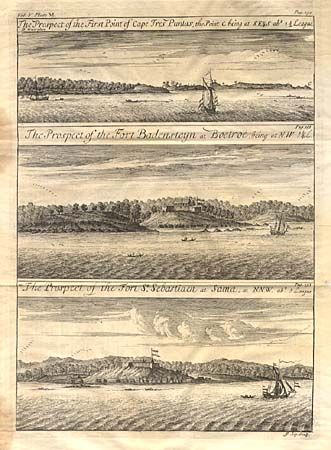
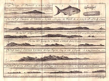
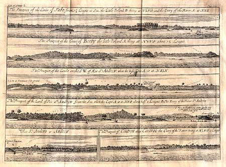
Subject: Africa - Western

Period: 1732 (published)

Publication: A Collection of Voyages and Travels

Color: Black & White

Size:
14.5 x 9.6 inches
36.8 x 24.4 cm
Download High Resolution Image
(or just click on image to launch the Zoom viewer)

An interesting map of the coast from Cape Formosa to the Dony River stated on the map to be "drawn very exactly on the Spot in the Year 1699 by several Pilots Jointly." Filled with soundings, showing the locations of shoals and oriented by a compass rose and rhumb lines. Together with four sheets containing prospect views of forts and anchorages along the coast. They accompanied "A Description of the Coasts of North and South Guinea and of Ethiopic Inferior…" by John Barbot in Vol. V.

References:

Condition: B

Damp stains just entering map at top.

Estimate: $150 - $200

Unsold

Closed on 3/5/2003

Archived