Subject: Africa
Period: 1877 (dated)
Publication: Stieler's Hand-Atlas
Color: Hand Color
Size:
16 x 12.8 inches
40.6 x 32.5 cm
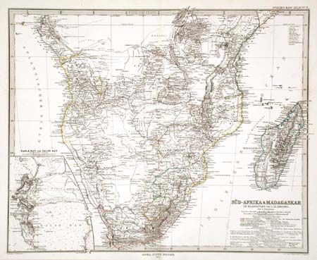
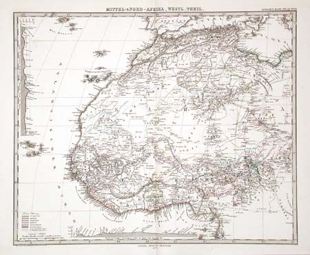
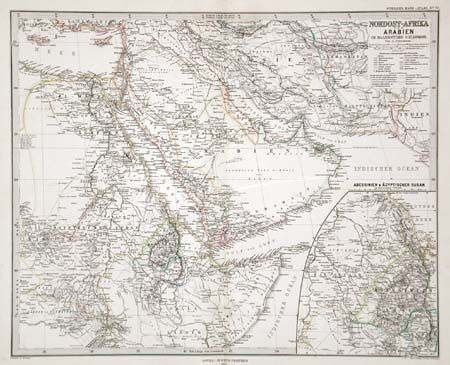
Very nice lot of maps: Sud-Afrika & Madagaskar features the southern tip of Africa, with an inset of Table Bay and False Bay. Extensive detail from Somali to Capeland and including the Island of Madagascar. Native African tribes are also noted, along with explorer's routes. Mittel-& Nord - Afrika, Westl, Theil shows from Algeria and Tripoli to St. Thomas Island and Wadai. Excellent detail of colonial claims. Nordsost-Afrika un Arabian extends from Syria to Afghanistan and from Egypt to Somalia. Inset is a map of Abyssinia and the Egyptian Sudan. The delicate hand coloring delineates the political and ethnographic boundaries of the region at the time.
References:
Condition: A
Some tape repairs to verso of Nordost-Afrika that also has some light soil, others fine.