Catalog Archive
Auction 102, Lot 485

"Carte de l'Ile de Java: Partie Occidentale, Partie Orientale. Dressee Tout Nouvellement sur les Memoires les Plus Exacts…", Chatelain, Henry Abraham

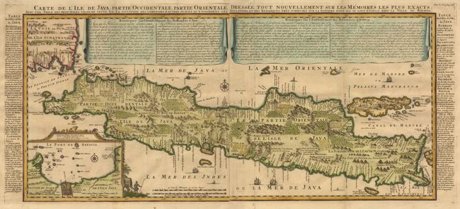
Subject: Java Indonesia

Period: 1719 (circa)

Publication: Atlas Historique

Color: Hand Color

Size:
34.2 x 15 inches
86.9 x 38.1 cm
Download High Resolution Image
(or just click on image to launch the Zoom viewer)

This important large-scale chart of the island of Java is one of the finest 18th century maps of the island. The map is filled with details of rice fields, mountains, forests, cities, villages and even elephants. A large inset features the important Dutch trading capital of Batavia (present day Jakarta). The superb detail is complemented by an extensive textual description (French) contained in a drapery style cartouche and side panels. Two sheets joined as issued.

References: Koeman CHA 6:9.

Condition: A+

Estimate: $2,000 - $2,200

Sold for: $1,500

Closed on 3/5/2003

Archived