Catalog Archive
Auction 102, Lot 376
"Carte des Pays Bas Comprenant Les Provinces Unies Le Brabant Gueldre, Limbourg, Luxenbourg, Haynaut, Namur, Flandre, Cambresis et Artois", Anon.
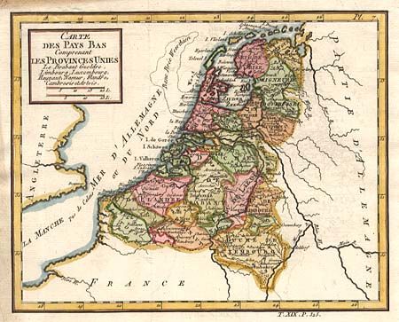
Subject: Netherlands, Belgium and Luxembourg
Period: 1750 (circa)
Publication:
Color: Hand Color
Size:
8.6 x 6.9 inches
21.8 x 17.5 cm
Download High Resolution Image
(or just click on image to launch the Zoom viewer)
(or just click on image to launch the Zoom viewer)