Catalog Archive
Auction 102, Lot 223
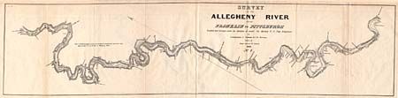
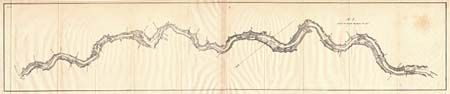
"Survey of the Allegheny River from Franklin to Pittsburgh…No. 1 [with] No. 2 Drawn by Lieut.. Ramsay 1st Arty.", U.S. War Department
Subject: Pennsylvania
Period: 1828 (dated)
Publication: HR Doc. 343, 25th Congress 2nd Sess.
Color: Black & White
Size:
See Description
Download High Resolution Image
(or just click on image to launch the Zoom viewer)
(or just click on image to launch the Zoom viewer)