Catalog Archive
Auction 102, Lot 210

"[Southwest sheet of Province de New-York]", Montresor, John

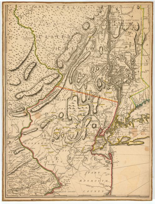
Subject: New York - Revolutionary War

Period: 1777 (circa)

Publication: Atlas Ameriquain Septentrionale…

Color: Hand Color

Size:
20.5 x 27.5 inches
52.1 x 69.9 cm
Download High Resolution Image
(or just click on image to launch the Zoom viewer)

This is the lower left sheet of the four-sheet, French edition of Montresor's important map by George Le Rouge, with place names in English. This Revolutionary War period map includes New York City and extends from the tip of Long Island to the border of Pennsylvania and north to Livingston. This unusual map shows counties, land grants, churches, forts, manors and the names of some residents among its amazing details.

References: Sellers & van Ee #1068; Phillips, P. L. (Atlases) #1212.

Condition: B

Map is laid on old linen. Some small damp stains.

Estimate: $2,000 - $2,400

Unsold

Closed on 3/5/2003

Archived