Catalog Archive
Auction 102, Lot 205
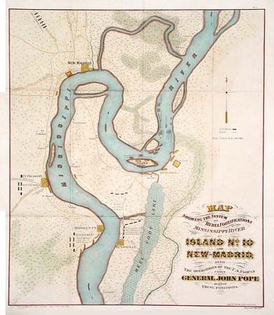
"Map Showing the System of Rebel Fortifications on the Mississippi River at Island No. 10 and New Madrid , Also the Operations of the U. S. Forces under General John Pope Against These Positions", U.S. War Department
Subject: Missouri
Period: 1862 (circa)
Publication: Report of Maj. Gen. Pope to the Committee on the Conduct of the War
Color: Hand Color
Size:
17.2 x 20 inches
43.7 x 50.8 cm
Download High Resolution Image
(or just click on image to launch the Zoom viewer)
(or just click on image to launch the Zoom viewer)