Catalog Archive
Auction 102, Lot 166

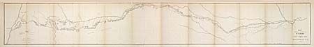
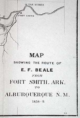
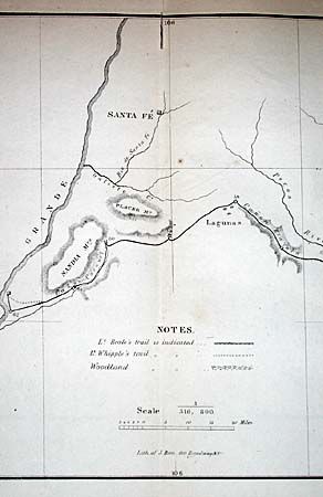
"Map Showing the Route of E. F. Beale from Fort Smith, Ark. To Alburquerque N.M. 1858-9", U.S. Government

Subject: United States - Southwest

Period: 1860 (published)

Publication: HR Doc 42, 36th Cong. 1st Sess.

Color: Black & White

Size:
48.5 x 7 inches
123.2 x 17.8 cm
Download High Resolution Image
(or just click on image to launch the Zoom viewer)

Beale [1822-1893] had a long career in the West including Indian Agent, surveyor and camel driver. His most lasting contribution was as a road builder. This map resulted from the survey of a road across present-day Oklahoma, Texas and New Mexico that originally appeared in Beale's "Construction of a Wagon Road from Fort Smith to the Colorado River." His route roughly follows the Canadian River. It also closely parallels or is identical to that of Lt. Whipple just a few years earlier. A dotted line indicates where the routes diverge. Beale's 62 camp sites are numbered by day. Excellent detail along the route.

References: Wheat [TMW] #939; Koepp #1048.

Condition: A

Folding, as issued.

Estimate: $250 - $350

Sold for: $325

Closed on 3/5/2003

Archived