Subject: Western Hemisphere
Period: 1794 (dated)
Publication:
Color: Hand Color
Size:
47 x 40.6 inches
119.4 x 103.1 cm
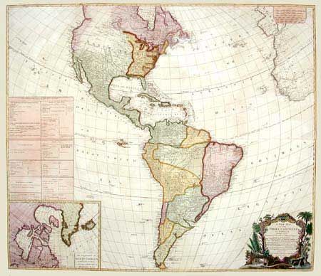
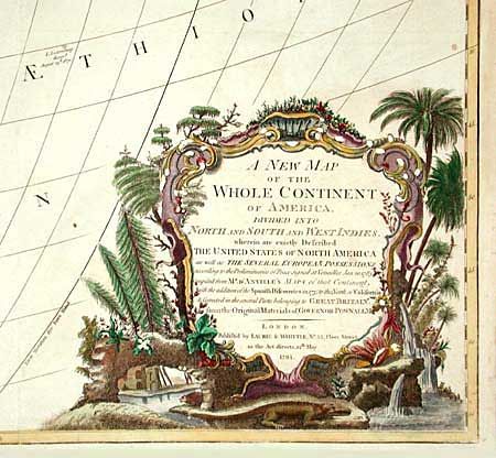
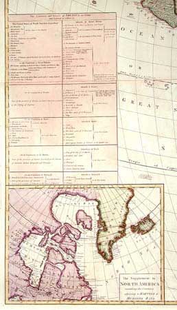
An impressive, four-sheet map of North and South America, originally drawn by John Gibson in 1763 with a slightly different title. The map went through several revisions; this being the final state. The huge map is filled with incredible detail and is based on D'Anville's cartography, as well as Spanish explorations on the west coast of North America and the journals of Governor Pownall in New England and Canada. The new United States is shown with its boundary on the Mississippi River. In the west are two possible locations for a River of the West; one with its source at Pike's Lake, the other further north at Lake Winnipeg. A Chinese colony, Fou Sang is shown in present-day British Columbia. At lower left is an inset map of Hudson and Baffin's Bay. Above the inset is a large text panel listing of the states of the United States and the colonial possessions of the various European powers. The baroque style title cartouche features a beaver, a crocodile and an Indian headdress amid trees, a waterfall and tropical flora.
References: Tooley (America) p. 52, #3.f.
Condition: A
Professionally backed with light Japanese tissue to strengthen areas of original color oxidation. Although there is still some very minor discoloration it is in very good condition for such a large piece.