Subject: East Indies - Indonesia
Period: 1640 (circa)
Publication:
Color: Hand Color
Size:
19.2 x 14.5 inches
48.8 x 36.8 cm
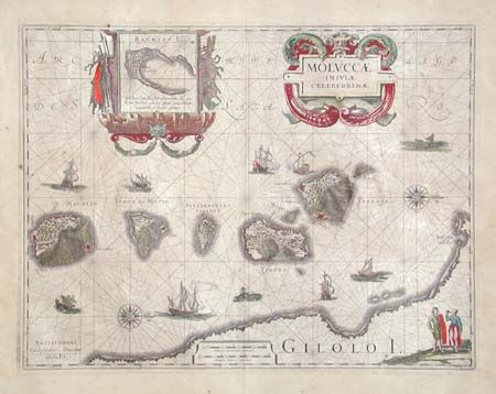
Superb map of the Spice Islands based on the islands described by Jan Huyghen van Linschoten. This map was the first large-scale map of the region and depicts the islands that provided first the Portuguese, and then the Dutch, with a monopoly on the lucrative spice trade. Each of the islands is shown with groves of the prized clove and nutmeg trees and the location of their protective fortresses. Originated by Jodocus Hondius, the plate was purchased by Bleau in 1629. Very decorative title cartouche and a cartouche enclosing an inset map of Bachian Island. Other decoration includes 2 compass roses, various types of sailing ships, and sea monsters.
References:
Condition: B
Great original color. Lightly toned with a few tiny foxing spots. Remnants of masking tape on edges of verso with some resulting tape stain in margins, well away from the map.