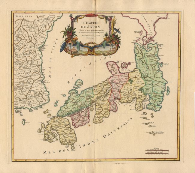
Subject: Japan and Korea
Period: 1750 (dated)
Publication: Atlas Universel
Color: Hand Color
Size:
21 x 18.8 inches
53.3 x 47.8 cm
Large map of Japan with a distinctively French style title cartouche containing two small landscapes. The map draws heavily on the previous work of Bellin, but includes a number of improvements to Terre d' Yedso (Hokkaido) similar to the manuscripts of Engelbert Kaempfer. The fictitious island of Matsumae is removed and now Matsaki is shown as a part of Yedso. The provinces are clearly outlined and there are many place names. The eastern part of the Korean peninsula is also shown with a good amount of detail. This great map was to influence the cartography of Japan well into the 19th century. This is the rare first state, without the block cartouche around the distance scale.
References: Walter #86; Pedley #410.
Condition: A+
On fine thick, watermarked, paper with huge side margins with two minor tears closed with archival tape (5 inches from the image). One tiny rust spot, still very fine.