Subject: England
Period: 1675-98 (published)
Publication: Britannia
Color: Hand Color
Size:
17.6 x 13.5 inches
44.7 x 34.3 cm
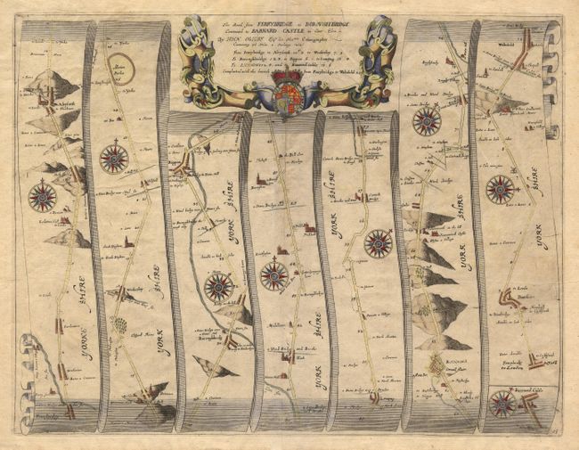
John Ogilby's 'Britannia' was published between 1675 and 1698. It is a landmark in the mapping of England and Wales. Its unique format constituted the first national road-atlas of any country in Western Europe. It was composed of maps of seventy-three major roads and cross-roads, presented in a continuous strip-form, on a uniform scale of one inch to a mile. Each beautiful map includes wonderful detail of the countryside with each strip containing a large compass rose to indicate changes in direction.
This map covers seventy-six miles of roads in the county Yorkshire. A windmill is shown four miles east of Pontesract. Eight lovely compass roses in full color. Finely engraved cartouche with gold highlights to the crown.
References:
Condition: B
Area of printer's creases and a little weak impression in a few areas. Good color and paper.