Subject: England - London
Period: 1756 (published)
Publication: Maitland's History and Survey of London
Color: Black & White
Size:
9.2 x 14.2 inches
23.4 x 36.1 cm
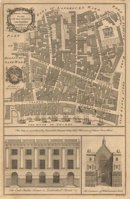
These copperplate engravings were published in William Maitland's History and Survey of London, 1756. They are very detailed maps of the streets, lanes, alleys and courts in the ancient city of London. They are richly embellished with architectural profiles of major churches or important buildings, the arms of the mayor and aldermen, elaborate title cartouches and compass roses.
Plan of Tower Ward at the south-east corner of the City of London, taking in (Lower) Thames Street, the Custom House, the churches of St. Dunstan in the East, Allhallows Barking and St. Olave Hart Street, (Great) Tower Street, Mark Lane, Mincing Lane and Seething Lane. The map is decorated with a title cartouche, the arms of the contemporary alderman (Thomas Chitty) and elevations of East India House and Westminster Hall.
References:
Condition: B
Couple of very light foxing spots. Binding stitch holes close to neatline, else very good.