Subject: World
Period: 1748 (dated)
Publication:
Color: Black & White
Size:
27.4 x 19.7 inches
69.6 x 50 cm
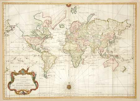
A very large world chart on Mercator's projection. North America is shown with a Fl. de l'Ouest connecting through a series of rivers and lakes from Lake Superior to the Pacific. The Russian discoveries in the North Pacific show Alaska as an island (I. Unamak). Australia is labeled Nouvelle Hollande with Terre de Diemen linked to the mainland. New Zealand and the Solomon Islands appear in the Pacific. Large, decorative title cartouche and two fine compass roses with rhumb lines make this a very attractive chart. While dated 1748, the geography indicates a publish date of circa 1770.
References:
Condition: B
Tiny worm track along centerfold and a couple of tiny separations at fold intersection, none distracting. Overall a nice crisp impression and lovely color.