Catalog Archive
Auction 101, Lot 216
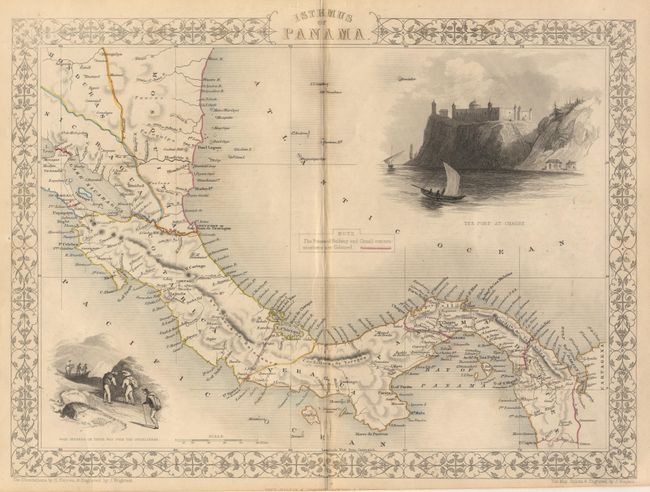
"Isthmus of Panama", Tallis, John
Subject: Central America - Panama
Period: 1851 (circa)
Publication: Illustrated Atlas
Color: Hand Color
Size:
13 x 9.6 inches
33 x 24.4 cm
Download High Resolution Image
(or just click on image to launch the Zoom viewer)
(or just click on image to launch the Zoom viewer)