Catalog Archive
Auction 101, Lot 173

"Plan of Detroit by John Mullett", U.S. Government
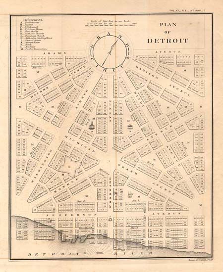
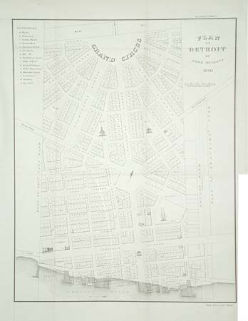
Subject: Michigan

Period: 1860 (published)

Publication: American State Papers. Public Lands, Vol 6

Color: Black & White

Size:
14 x 17.8 inches
35.6 x 45.2 cm
Download High Resolution Image
(or just click on image to launch the Zoom viewer)

An important key map of early Detroit. The downtown shows Judge Woodward's plan of the Grand Circus, the Campus Martius, and the waterfront. The major building elevations are depicted, as well as numbered lots, sections, and sewers with a table of references to important features. Lithographed by Bowen & Co. Plus a smaller Plan of Detroit (8.3 x 9.9") from the John Farmer, American State Papers. The pair.

References:

Condition: A

Sound paper with full margins. One tiny spot and a little light offsetting.

Estimate: $325 - $375

Unsold

Closed on 12/4/2002

Archived