Catalog Archive
Auction 100, Lot 99

"Partie de la Carte du Capitaine Cluny Auteur d'un ouvrage anglois intitule American Traveller", Robert de Vaugondy, Didier

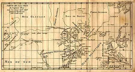
Subject: North America - Arctic

Period: 1769 (dated)

Publication: The American Traveller

Color: Black & White

Size:
16.3 x 8.3 inches
41.4 x 21.1 cm
Download High Resolution Image
(or just click on image to launch the Zoom viewer)

Depicts North America from above the Arctic Circle to the Gulf of Mexico. The most important feature of the map is the early depiction of what is present day Alaska, and is patterned after Muller's epic map of 1750 that was the first to show the Russian discoveries, also noted here. A very interesting Northwest Passage is shown going from Repulse Bay in the north part of Hudson's Bay into the Arctic Ocean at Cape Fowler. Good detail of Baffin's Bay and Hudson's Bay.

References: Wagner (NW) #637-10.

Condition: B

Faint offsetting that can easily be erased and a few light spots.

Estimate: $160 - $200

Unsold

Closed on 9/12/2002

Archived