Subject: North America
Period: 1719 (dated)
Publication:
Color: Hand Color
Size:
25 x 18 inches
63.5 x 45.7 cm
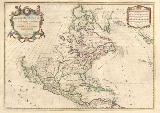
Second state of this great map issued at the height of the California as an Island controversy. The first issue, in 1689, showed California clearly as an island with an indented northern coastline and Sanson's characteristic islands in the Mare Vermejo. In this edition, the map was updated but leaves the question of California's insularity open by eliminating the land to its north and west, but leaving a gap at the head of the Mare Vermejo. The Great Lakes are now shown complete and the Rio del Norte now flows correctly into the Gulf of Mexico. The lion's share of today's United States is divided between Floride and Nouveau Mexique. Lovely title cartouche with Native Americans and tropical birds at upper left, balanced by the distance scale cartouche on right.
References: McLaughlin #101.
Condition: B
Tissue repair of folds, well away from map. Light spotting in cartouche and off the coast of Greenland, else very good.