Catalog Archive
Auction 100, Lot 304

"[2 sheets] Irlandiae Regnum", Mercator, Gerard
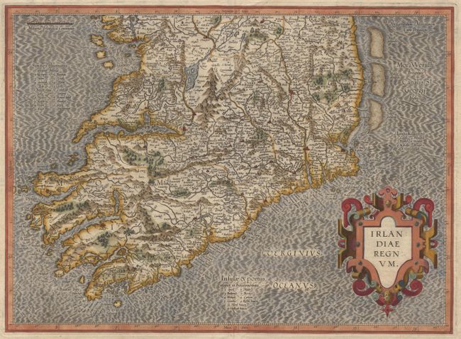
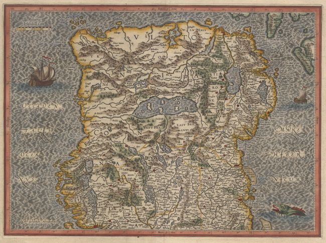
Subject: Ireland

Period: 1630 (published)

Publication:

Color: Hand Color

Size:
18.3 x 13.4 inches
46.5 x 34 cm
Download High Resolution Image
(or just click on image to launch the Zoom viewer)

Superb early pair of maps covering the whole of Ireland. These two maps were among five Irish maps Mercator designed for the second part of his Atlas. The maps are richly engraved with a moiré pattern in the seas and strong topographical features in the interior. The northern section is decorated with sailing ships and a sea monster and there is no title cartouche - only Mercator's imprint. The southern sheet features the bold, strapwork title cartouche. Size is for each map. A matched pair from the Latin edition of 1630.

References: Law p. 20

Condition: A+

Estimate: $1,100 - $1,300

Sold for: $1,000

Closed on 9/12/2002

Archived