Catalog Archive
Auction 100, Lot 267

"Nieuwe Pas-Caart: Vertoonende, hoemen uy t' de Canaal, de Custen van Portugael, Barbarijen, de Canarische en Vlaemsche Eylanden beseylen zal", Doncker, Henrick

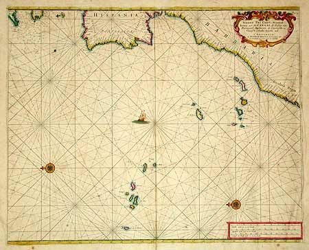
Subject: Eastern Atlantic

Period: 1670 (circa)

Publication:

Color: Hand Color

Size:
21 x 17 inches
53.3 x 43.2 cm
Download High Resolution Image
(or just click on image to launch the Zoom viewer)

Handsome sea chart with north oriented to the left by two decorative compass roses. Parts of the European coastline from Plymouth, England through the Gualata Regio on the Barbary coast of Africa are detailed at the top of the chart. Includes the strategic Canary and Azores island groups. Rhumb lines, a tiny sailing ship, and a decorative cartouche.

References:

Condition: B

Beautiful original color. Toned with a split on bottom fold entering the map 1 1/2". Some foxing and damp stain in margins. Backed with 18th or 19th century paper for additional strength, as is common for sea charts.

Estimate: $350 - $450

Sold for: $250

Closed on 9/12/2002

Archived