Subject: Colorado
Period: 1895 (dated)
Publication:
Color: Printed Color
Size:
54 x 41.5 inches
137.2 x 105.4 cm
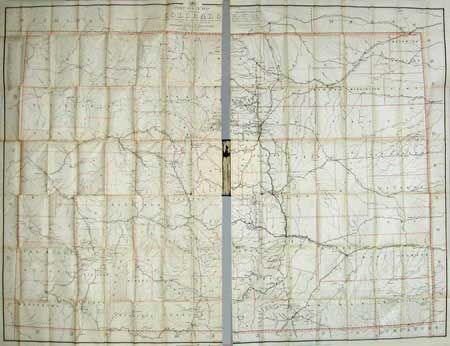
Folding map in original cloth covers with gilt and embossing. Map in two sections, attached to boards. Super large-scale map (five miles to the inch) of the state showing the various postal routes with frequency of delivery noted (from once to six times a week), special supply routes and mail message routes. The current and discontinued offices are located. Inset table lists the counties. The map was made in 1892 by Alexander von Haake, of the Topographical Engineering Dept. and updated for Postmaster General William L. Wilson to Sept. 1, 1895. A rare and seldom seen issue.
References:
Condition: C
Minor toning of folds with several separations of folds, without apparent loss. Paper is toned, else good.