Catalog Archive
Auction 100, Lot 161

"Preliminary Map of the Western Portion of the Reconnaissance and Survey for a Pacific Railroad Route Near the 35th Parallel Made by Capt. A.W. Whipple. T.E. in 1853-4…", Whipple, Amiel Weekes

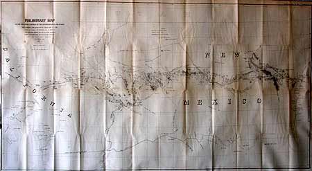
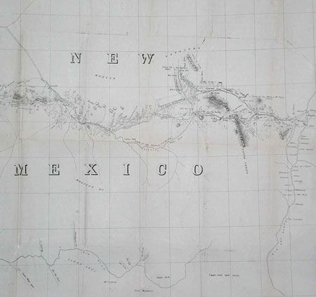
Subject: United States - Southwest

Period: 1858 (published)

Publication: HR Doc. 124, 35th Cong. 1st sess.

Color: Black & White

Size:
49 x 26 inches
124.5 x 66 cm
Download High Resolution Image
(or just click on image to launch the Zoom viewer)

Large lithographed map covering from Albuquerque to Los Angeles . The map documents part of the famous expedition in which E.F. Beale took a group of camels from the Gulf Coast to Fort Tejon in California. In addition to Beale's route, which eventually became the route of the Santa Fe Railroad, the map also shows Cook's wagon road, Sitgreaves route, and Aubrey's trail of 1854. The future site of Phoenix is here Coco Maricopa and Pima Villages. Numerous interesting notes concerning Indian villages and topography. Beale advocated the construction of dams and military posts along the way to facilitate passage of emigration to the West Coast.

References: Wheat (TMW) 939.

Condition: B

Good impression on sound paper. Issued folded, now backed with archival tissue.

Estimate: $200 - $250

Sold for: $300

Closed on 9/12/2002

Archived