Subject: United States - Southwest
Period: 1851 (circa)
Publication: Sen. Doc. 119, 32nd Cong. 1st Sess.
Color: Black & White
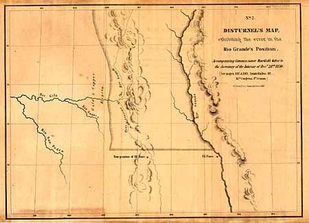
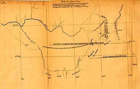
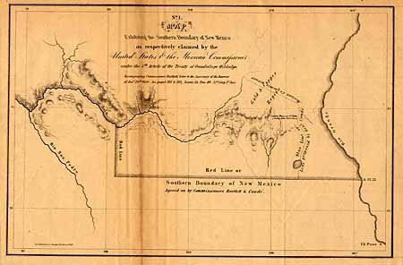
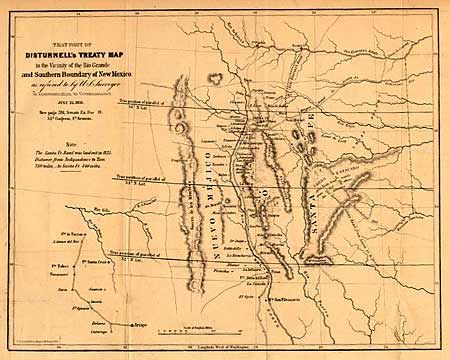
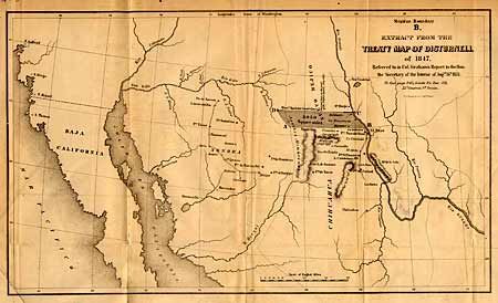
The process of surveying the US-Mexican Boundary was beset by politics, interdepartmental rivalries and personal conflicts from the beginning. Ultimately, the dispute between the principals (mainly Bartlett and Graham) made its way to the floor of Congress and the claims and counterclaims ended up in numerous government documents. Senate Doc 119 is the source of these seven maps. The two most important maps are "Extract from the Treaty map of Disturnell of 1847..." [Wheat TM 718] and "That Part of Disturnell's Treaty map in the vicinity of the Rio Grande Valley and Southern Boundary of New Mexico" [Wheat TM 720]. The remaining maps show details of the surveyed area and illustrate the errors in the Treaty Map.
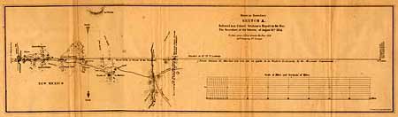
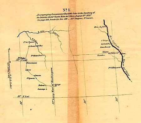
Remaining maps are: "No. 1 Accompanying Commissioner Bartlett's letter…", "Mexican Boundary, Sketch A. Referred to in Colonel Graham's Report…", " No. 1 Map Exhibiting the southern boundary of New Mexico as respectively claimed by the United States & the Mexican Commissioner", "No.2 (From Emory's Map)", and "No.2. Disturnell's Map, exhibiting the error in the Rio Grande's Position."
References: Wheat 703 - 719.
Condition: B
Condition varies from good to very good, due to light toning.