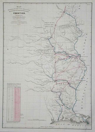
Subject: United States - Central Midwest
Period: 1838 (published)
Publication: Senate doc 65, 25th Cong., 2nd Session
Color: Hand Color
Size:
15.2 x 21.5 inches
38.6 x 54.6 cm
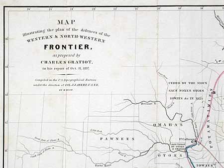
This map is from the series of maps that illustrated the factious Congressional debate over the nature of the Frontier Defenses between the Mississippi River and the Rocky Mountains. Issued under the direction of Col. A.A. Abert by W. Hood, the map depicts the states of Missouri, Arkansas, Louisiana and Indian nations bordering them to the west. It shows the locations of many military forts and outposts from Ft. Jessup to Ft. Snelling with notations throughout concerning lands ceded by several Indian nations with dates of the treaties. The threat posed by hostile Indians whose numbers greatly exceeded those of the settlers in the area, resulted in a protracted Congressional debate concerning the defenses required along the frontier. Gratiot’s plan uses color to trace the common roads and rivers. A table lower left notes distances between forts and "days of march" at 15 miles per day. This map should not be confused with a later printing (ca. 1860) in the American State Papers.
References: Wheat [TMW] 426.
Condition: A
Folding as issued. Good impression with two small areas of foxing, still a very nice example of this map.