Subject: United States - Central Midwest
Period: 1837 (dated)
Publication: Published Senate doc 65, 25th Cong., 2nd Session
Color: Black & White
Size:
15.5 x 21.5 inches
39.4 x 54.6 cm
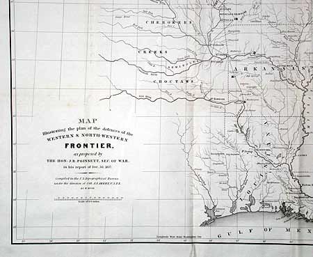
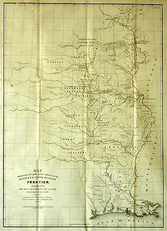
This map is from the series of maps that illustrated the Congressional debate over the nature of the Frontier Defenses between the Mississippi River and the Rocky Mountains. Issued under the direction of Col. A.A. Abert by W. Hood, the map depicts the states of Missouri, Arkansas, Louisiana and Indian nations bordering them to the west. It shows the locations of many military forts and outposts from Ft. Jessup to Ft. Snelling with notations throughout concerning lands ceded by several Indian nations with dates of the treaties. The threat posed by hostile Indians whose numbers greatly exceeded those of the settlers in the area, resulted in a protracted Congressional debate concerning the defenses required along the frontier. It was drawn by W. Hood and was issued in conjunction with a similar proposal by Charles Gratiot (see next lot). This map is the original issue and not to be confused with the re-issued version from the American State Papers, circa 1860.
References: Wheat [TMW] 426
Condition: A
Good impression, folding as issued.