Catalog Archive
Auction 100, Lot 114

"Neu Engeland, Neu York, Neu Iersey, und Pensilvanien &c", Moll, Herman

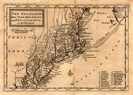
Subject: Colonial New England

Period: 1744 (published)

Publication: Das Britische Reich in America

Color: Black & White

Size:
10.2 x 7 inches
25.9 x 17.8 cm
Download High Resolution Image
(or just click on image to launch the Zoom viewer)

This is the German edition of Herman Moll's earliest map of New England, originally appearing in John Oldmixon's "The British Empire in America" in 1708. New York is confined to a narrow strip along the Hudson River and New Jersey is divided into East and West New Jersey. Small compass rose and engraved title block.

References: McCorkle 744-6.

Condition: B

A few spots along fold and tiny worm holes in the blank margins, else very good.

Estimate: $325 - $375

Sold for: $300

Closed on 9/12/2002

Archived