Showing Featured Lots(remove filter)
Filtered by Category:United States(Show All Categories)
Current Auction
11 lots
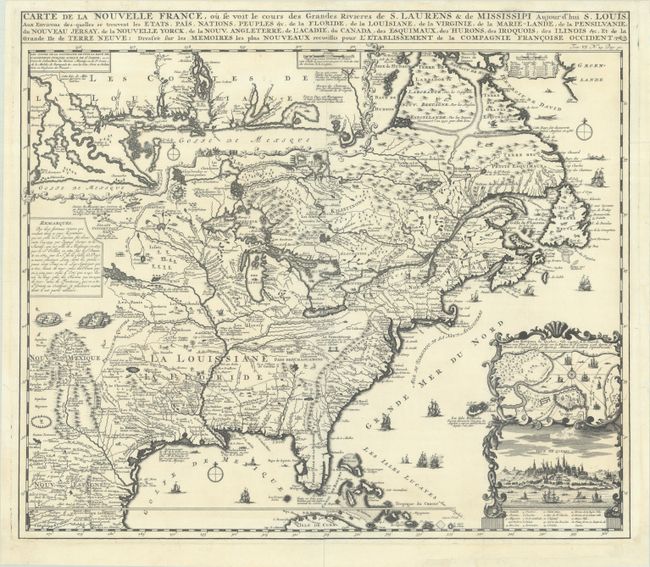
Lot 95
Subject: Colonial Eastern United States & Canada
Chatelain, Henry Abraham
Carte de la Nouvelle France, ou se Voit le Cours des Grandes Rivieres de S. Laurens & de Mississipi Aujour d'hui S. Louis, aux Environs des-quelles se Trouvent les Etats, Pais, Nations, Peuples, &c. de la Floride, de la Louisiane, de la Virginie..., 1719
Size: 19.3 x 16.7 inches (49 x 42.4 cm)
Estimate: $2,200 - $2,500
One of the Most Informative 18th Century Maps of the French Possessions in North America
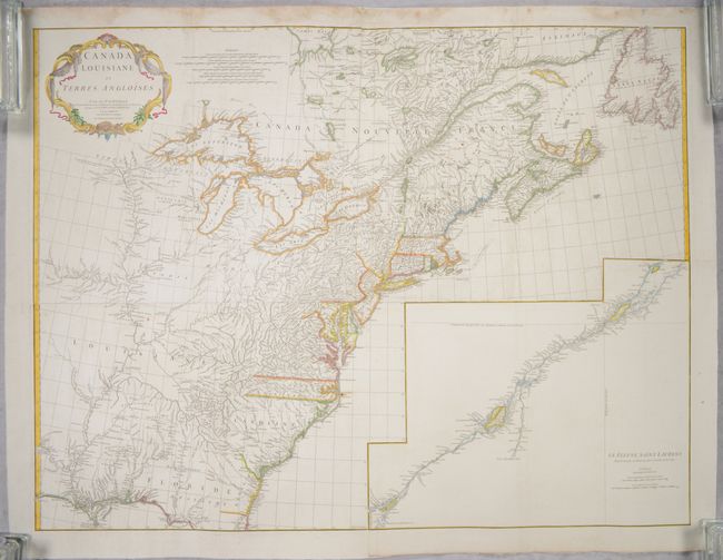
Lot 96
Subject: Colonial Eastern United States & Canada
Anville, Jean Baptiste Bourguignon d'
[On 4 Joined Sheets] Canada Louisiane et Terres Angloises, 1755
Size: 44.8 x 33.9 inches (113.8 x 86.1 cm)
Estimate: $1,400 - $1,700
D'Anville's Spectacular Map of Eastern Seaboard on 4 Joined Sheets
Sold for: $1,000
Closed on 6/18/2025
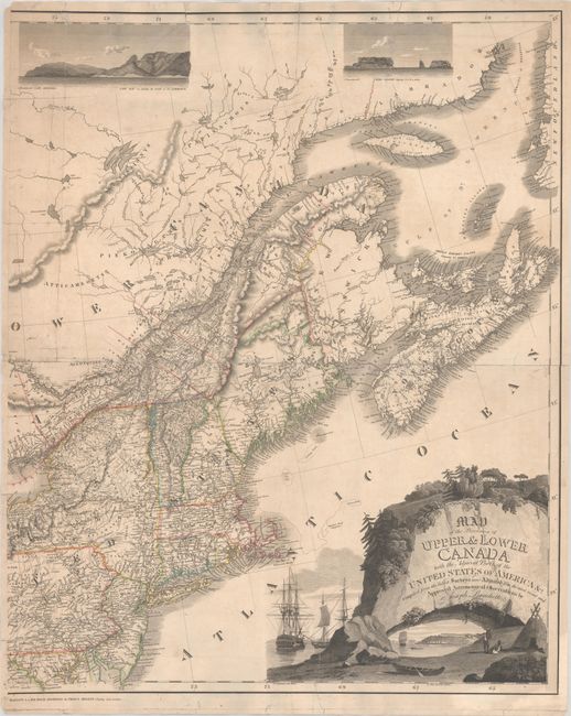
Lot 104
Subject: Northeastern United States & Canada
Bouchette, Joseph
[Eastern Sheet] Map of the Provinces of Upper & Lower Canada with the Adjacent Parts of the United States of America &c. Compiled from the Latest Surveys and Adjusted from the Most Recent and Approved Astronomical Observations, 1815
Size: 24.3 x 30 inches (61.7 x 76.2 cm)
Estimate: $2,400 - $3,000
Eastern Sheet of Bouchette's Rare Map Presenting Lower Canada and New England
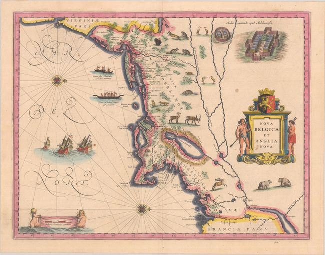
Lot 132
Subject: Colonial New England & Mid-Atlantic United States
Blaeu, (Family)
Nova Belgica et Anglia Nova, 1638
Size: 19.9 x 15.3 inches (50.5 x 38.9 cm)
Estimate: $1,600 - $1,900
Important Map of Colonial New England and the Mid-Atlantic
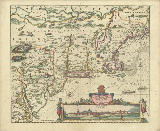
Lot 133
Subject: Colonial New England & Mid-Atlantic United States
Danckerts, Justus
Novi Belgii Novaeque Angliae nec non Pennsylvaniae et Partis Virginiae Tabula Multis in Locis Emendata, 1690
Size: 21.4 x 18.2 inches (54.4 x 46.2 cm)
Estimate: $4,000 - $4,750
Danckerts' Decorative Map with Early View of New York City in Full Contemporary Color
Sold for: $3,000
Closed on 6/18/2025
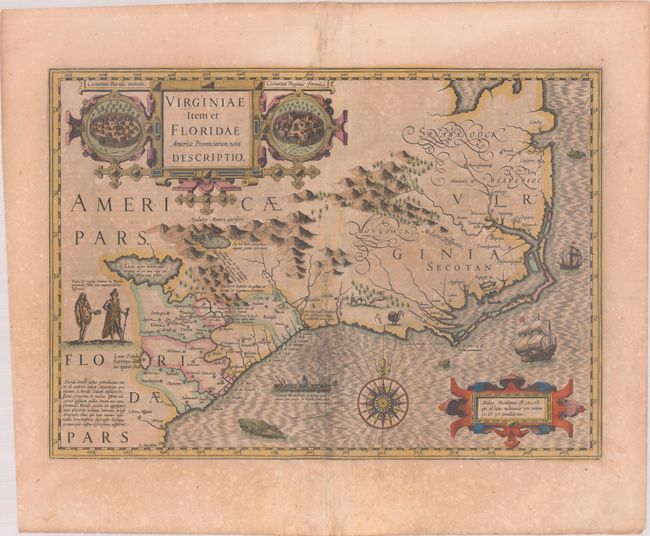
Lot 141
Subject: Colonial Southeastern United States
Hondius, Jodocus
Virginiae Item et Floridae Americae Provinciarum, Nova Descriptio, 1619
Size: 19.1 x 13.5 inches (48.5 x 34.3 cm)
Estimate: $1,400 - $1,700
A Seminal Map of the Southeast and Early American Cartography in Full Contemporary Color
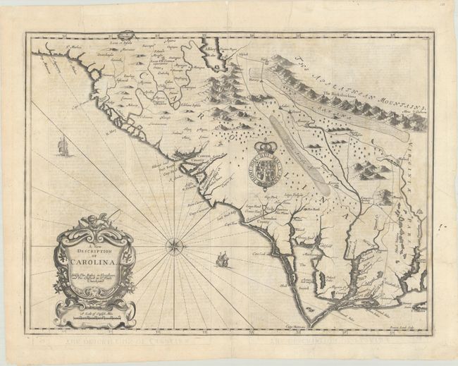
Lot 143
Subject: Colonial Southeastern United States
Speed/Lamb
A New Description of Carolina, 1676
Size: 19.8 x 14.8 inches (50.3 x 37.6 cm)
Estimate: $1,800 - $2,100
Speed's Map of the Carolinas Based Upon the Lords Proprietor's Map
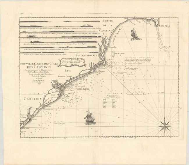
Lot 146
Subject: Colonial Southeastern United States
Le Rouge, George Louis
Nouvelle Carte des Cotes des Carolines Septentrionales et Meridionales du Cap Fear a Sud Edisto..., 1777
Size: 21.3 x 16.1 inches (54.1 x 40.9 cm)
Estimate: $1,000 - $1,300
Rare French Chart of the Carolina Coast
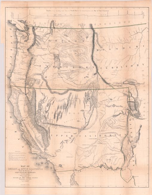
Lot 155
Subject: Western United States
Fremont/Preuss
[Map with Report] Map of Oregon and Upper California from the Surveys of John Charles Fremont and Other Authorities [with] Geographical Memoir upon Upper California..., 1849
Size: 26.7 x 33.3 inches (67.8 x 84.6 cm)
Estimate: $1,500 - $1,800
Fremont's Map of the American West with Report
Sold for: $1,100
Closed on 6/18/2025
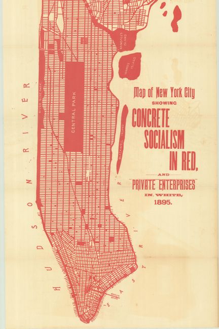
Lot 226
Subject: New York City, New York
Map of New York City Showing Concrete Socialism in Red, and Private Enterprises in White, 1895
Size: 13 x 39 inches (33 x 99.1 cm)
Estimate: $400 - $600
"A Powerful Example of Color Used to Make a Point" - PJ Mode
Sold for: $250
Closed on 6/18/2025
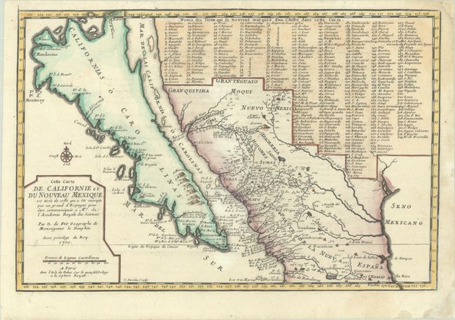
Lot 255
Subject: Southwestern United States & Mexico, California
Fer, Nicolas de
Cette Carte de Californie et du Nouveau Mexique, est Tiree de Celle qui a ete Envoyee par un Grand d'Espagne pour etre Communiquee a Mrs. de l'Academie Royale des Sciences, 1700
Size: 13.4 x 9 inches (34 x 22.9 cm)
Estimate: $1,100 - $1,400
De Fer's Important Map of the Island of California - First State
Sold for: $800
Closed on 6/18/2025
11 lots